Just before the Chilean checkpost, we passed three international bicycle riders. Tour bicycling is very popular, but it is incredibly difficult.
When we arrived at the border, we found that this was actually just a agriculture stop, where the inspectors look for and will seize any meats, cheese and vegetables. In order to pass through customs and immigration we were told that we must be in San Pedro today or be considered as illegally in the country. This changed our plans from wild camping in a park along the way. So we had to rush down the mountain, on the bad road for another 100km until we met up with a paved road, then we rushed another 70km into town. As a reward for the rough roads and long drive, we treated ourselves to dinner in town. We enjoyed a parrilada, a local version of a barbeque then made camp on the street under a street light.
|
May 19-21, 2006 - Salta & Paso de Sico Last night as the sun was going down, we noticed fog coming up over the mountains and settling into the canyon that we would be taking back down. We had been told this was a possibility for the drive, but our drive up was gorgeous and clear. So this morning when we left our beautiful wild camping spot in bright sunshine and headed out toward Salta we were pleased to see that there was no blanket of fog covering the hills.
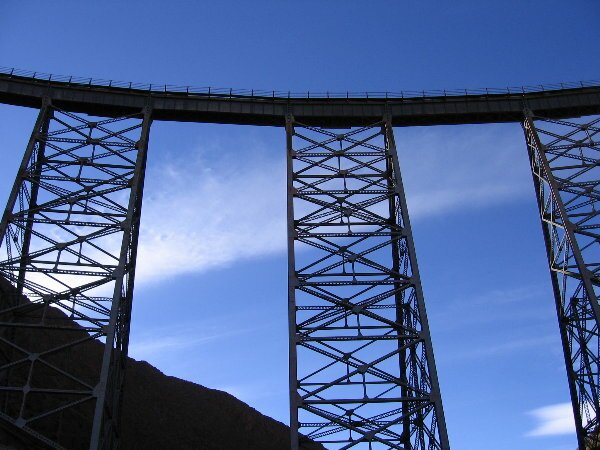
We drove several miles and entered the canyon. We noticed a significant increase in traffic and realized that it was Friday, and a lot of people come up to Cachi for the weekend. We were hoping that the traffic would thin out soon, as the canyon narrows down significantly toward the bottom. As we came around a curve with yet another tour bus coming at us, we were also surprised to see quite a bit of fog creeping up the canyon. Darn, fog and lots of traffic. We continued down, turning on our headlights, our running lights and our fog lights to be as visible as possible to oncoming traffic. Fortunately we only had a couple of scares, with cars traveling at imprudent speeds with limited visibility, but eventually the traffic thinned out and so did the fog. The overcast remained however and when we arrived in Salta in mid afternoon, it was cloudy and cool. However the weather did not detract from the warmth of the greeting that we received when we met up with old friends in the Municipal Campground. Salta has one of the nicest municipal campgrounds in Argentina, with the largest reputed swimming pool in the world. Overlanders gather here at all times of year to rest, regroup, re-supply and meet new people. The friends that we met up with were people we had met in Puerto Natales, Chile, back in mid-January. It was wonderful to see them and we spent the evening catching up on news and sharing information. The next morning we relaxed, hit the internet cafe and ran some errands. In the afternoon, we wandered around the campground and met travelers from Germany and the Netherlands. As is typical of overlanders, we shared stories and information. When you are on the road, it is very helpful to have up-to-date information on road conditions, camping spots, grocery stores, etc. We spent the evening once again with our friends. The next morning it was time to say goodbye and once again hit the road. The weather had remained overcast during our entire time in Salta, but as lunchtime approached and we entered the Quebrada del Toro, the weather cleared and beautiful blue sky appeared. The Quebrada del Toro is the canyon where the Tren a las Nubes (Train to the Clouds) ascends from Salta to San Antonio del los Cobres passing through 21 tunnels and crossing 31 bridges and 13 viaducts.
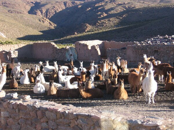
All the while we were winding higher and higher in elevation until we arrived at the elevation of 13,000 feet. It was right at this moment that we noticed a new light on the dashboard. Hmmm. We determined that it was a light indicating that the fuel system was unhappy with the limited amount of oxygen at the high elevation. We continued to drive and while we were accelerating the light would go off, but when we would slow down, the light would come back on. A little bit later, after climbing up another pass, we checked our GPS and found that we were at an even higher elevation, 14,700 ft (4523 meters)! We continued on to the town of San Antonio de los Cobres, and to the famous Viaducto La Polvorilla, a 224-meter viaduct that straddles a canyon at an elevation of 4,220 meters (13,800 ft). After gawking at the viaduct, we looked for a spot to camp for the night. Not really knowing what would happen when we tried to restart the truck in the morning (because of the warning light), we decided to camp close to the road. We chose a spot between a rock corral and the road and across from a ranchhouse. When the rancher returned from his day herding his 150 llamas, sheep and goats, we asked for permission to camp on his property. Permission was granted so we spent the night at an elevation of 13,134 feet and woke with frozen condensation on the inside of our windows.
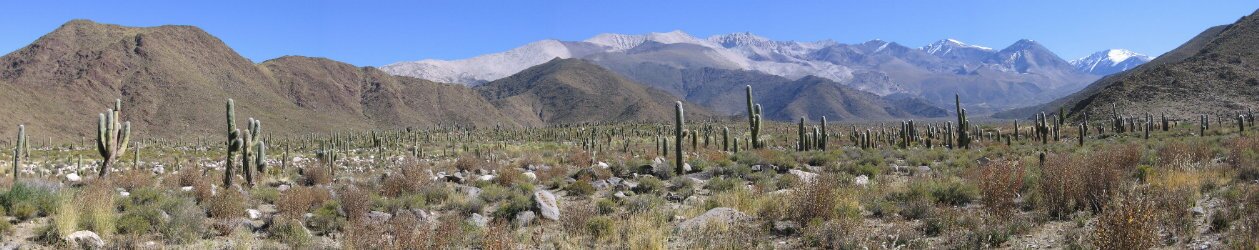
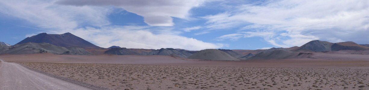
In the morning we continued onto the Chilean border at Paso de Sico. The roads got more washboarded, speeds slowed down, but we drove through gorgeous scenery. The landscape was very stark, but the altiplano vegetation of yellow grass gave the appearance of spring wildflowers. Closer to the border we passed through a region of high volcanic activity with craters and cinder cones and multi-color soil.
|