World of Wonders Project
The Mexico Expedition
![]()
|
|
|
Welcome to the first phase of the Around-the-World driving expedition of the World of Wonders Project. Read about the experiences that our explorers had while driving 5,070 miles (8,177 km) through Mexico in their specially equipped, satellite-linked expedition vehicle and explored the natural environment for eight weeks beginning on October 6, 2004. Learn about the culture and visit with the people of this diverse country. View the animal and bird life and explore the gold and silver boom towns built in the bottom of the canyons by the early miners. Wander the ruins of the past civilizations of the Meso-American Native people. Follow the links below to start the expedition. |
|
Journal |
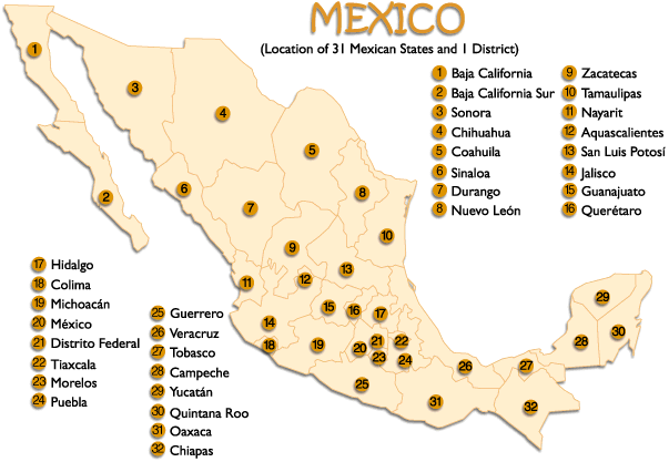
Click on either map to see it in detail
Expedition
|
The Republic of Mexico’s 31 states and one federal district covers almost 780,000 square mi (2 million square km) making it the world’s eight largest nation. The country curves from northwest to southeast, narrowing to the Isthmus of Tehuantepec in the south and then continuing northeast to the Yucatan Peninsula. To the west and south it’s bordered by the Pacific Ocean . The Sea of Cortes lies between the mainland and Baja California, the world’s longest peninsula. Mexico’s east coast is bordered by the Gulf of Mexico all the way from the US border to the northeastern tip of the Yucatan Peninsula . The eastern Peninsula faces the Caribbean Sea .
The northern border with the US is 1,947 mi long (3,141 km), the border in the south and east with Guatemala is 596 mi (962 km) and the border to the east with Belize is 155 mi (250 km). The coastline totals 5,785 mi (9330 km).
The northernmost portion of Mexico is covered by two different deserts. The largest is the Chihuahuan desert which covers approximately 176,700 sq mi (453,000 sq km) and is centered between the Sierra Madre Occidental and Sierra Madre Oriental mountain ranges. The Sonoran desert covers about 86,000 sq mi (221,000 sq km) and ranges from the majority of the Baja peninsula and the northwestern portion of the mainland.
Northern and central Mexico have also have coastal plains on the east and west and two north/south mountain ranges framing a group of broad central plateaus known as the Altiplano Central. The Altiplano Central is divided into northern and central parts, themselves split by minor ranges and varies in altitude from about 3,300 ft (1,000 mt) in the north to more than 6,500 ft (2,000 mt) in the center of the country. The central plateau is mostly rolling hills and broad valleys and includes some of the best farm and ranch land in the country. The altiplano is bound on the east by the Sierra Madre Oriental and includes peaks as high as 12,000 ft (3,700 mt). The Gulf Coast plain is an extension of a plain in the US and is wide in the north but narrows as it nears the port of Veracruz .
South of the Altiplano Central and the two Sierra Madres, the Cordillera (mountain range) Neovolcanica runs east-west acress the country. This range includes the active volcanoes Popocatepetl (17, 800 ft; 5,452 mt) and Volcan de Fuego de Colima (13,000 ft; 3,960 mt), as well as Mexico’s other highest peaks, Pico de Orizaba (18,000 ft; 5,611 mt), Iztaccihuatl (17,300 ft; 5,286 mt) and Paricutin (9,200 ft; 2,800 mt).
The Pacific lowlands cover a narrow strip west of Guadalajara. The Sierra Madre del Sur stretches across Guerrero and Oaxaca to the Isthmus of Tehuantepec the narrowest part of Mexico. The north side of the isthmus is part of a wide, marshy plain stretching from Veracruz to the Yucatan Peninsula. In the southernmost states the Pacific lowlands are backed by the Sierra Madre de Chiapas, the Rio de Grijalva basin and the Chiapas highlands. Each of these highlands is a tropical rainforest area stretching into northern Guatemala. The jungle turns into a region of tropical savanna on the flat, low Yucatan Peninsula and at the tip of the peninsula, an arid desert-like region.
Northwestern Mexico and inland northern areas are drier than the rest of the country. It is hot in the summer and north winds can make inland northern Mexico chilly in winter, with temperatures sometimes approaching freezing. Inland at higher elevations, the climate is also dry and temperate, and the mountain peaks are often capped with snow.
The Tropic of Cancer cuts across Mexico near Mazatlan and Ciudad Victoria and south of the tropic it’s hot and humid all year long along the coastal plains on either side of the country. The hot, wet season runs from May to October with the hottest and wettest months falling between June and September for most of the country. Low-lying coastal areas are wetter and hotter than elevated inland ones. Though the hottest summer extremes are generally found on the coastal plains, temperatures in the Altiplano and the Plataforma Yucateca often reach higher than 100 degrees F (38 degrees C).
In the east, rainfall is high on the eastern slopes of the Sierra Madre Oriental and on the northern side of the Isthmus of Tehuantepec . On the Yucatan Peninsula, along the mainland Pacific coast, along the Gulf coast north of Veracruz and in the Depresion de Balsas, annual rainfall reaches 30 inches (80 centimeters) or more. Mexico’s highest rainfall totals are in northeastern Chiapas and along the Gulf coastal plains of Tabasco with over 98 inches (250 centimeters) per year.
What is the weather like in the Mexico today? Follow this link to The Weather Underground for the forecast for the cities visited by our explorers. Or check out this satellite map from Weather.com.
Try converting the temperature in your town from Fahrenheit to Celsius.
What time is it in different cities in Mexico as compared to the time in your home town? Check this!
| Geography |
|
|
Pre-Hispanic History The first traces of human habitation in Mexico appeared 20,000 years ago with the first people hunting animals in the highland valleys. Agriculture began around 6500 BC in the Teohuacan valley with the growing of chile peppers and squash and progressed to a primitive form of corn between 5000 and 3500 BC. Mexico’s first “civilization” appeared on the Gulf coast near what is now known as Veracruz. These were the Olmecs. Known for their giant stone sculptures of heads, they had two main centers: San Lorenzo , which flourished from about 1200 to 900 BC, and La Venta in Tabasco, which flourished until about 600 BC. By 300 BC village life based on agriculture and hunting was established throughout the southern half of Mexico. Monte Alban was the center for the Zapotec people and had perhaps 10,000 inhabitants. It is suggested that this is where writing and the calendar were invented in Mesoamerica . The Izapan culture near Chiapas and the Pacific coast flourished from about 200 BC to 200 AD. The Izapas are considered to be the link between the Olmecs and the Maya. Between 100 BC and 700 AD a great civilization arose near present day Mexico City. Researchers are not certain who built it, but Teotihuacan grew into Mexico’s biggest city with an estimated population of 200,000. At its peak, it may have controlled the southern two-thirds of Mexico, all of Guatemala and Belize and parts of Honduras and El Salvador. In the 7th century, the power of Teotihuacan was destroyed, most likely by rivals in central Mexico, but the spectacular city survives today. Pre-Hispanic America’s most brilliant civilization, were the Maya. They thrived between about 250 and 900 AD and developed a calendar and writing system. A typical Mayan city functioned as the hub for the surrounding farming hamlets. Its ceremonial center focused on plazas surrounded by tall temple pyramids and lower buildings called palaces. Stelae and altars were carved with dates, histories and elaborate human and divine figures. Religion played a large role in the Maya’s lives, as did their devotion to a ball game most likely played by two teams in an arena with sloping walls. The purpose of the games is uncertain but games could be followed by the sacrifice of one or more of the players – whether winners or losers, no one is sure. Mayan cities could be found in the modern-day states of Chiapas (Bonampak and Palenque), Campeche (Rio Bec and Chenes) and the Yucatan (Uxmal). The collapse of the Mayan civilization came in the early 10th century probably due to population pressure and ecological damage caused by the large cities. Another civilization that had great influence, but is not widely understood is the Toltec. Around the 10th century the Toltecs moved into central Mexico and Tula became their capital, growing to a city of 30,000-40,000. The Toltecs may have “popularized” mass sacrifices as a way to appease the gods and a king named Tezcatlipoca may have demanded a steady diet of hearts from sacrificed warriors. It is from Tula that the god Quetzalcoatl fled, vowing to return some day. The Mayan site of Chichen Itza in northern Yucatan contains many Tula-like features including murals portraying sacrifices and reclining figures holding dishes that may have been receptacles for parts removed during sacrifices. Many researchers believe that Toltec exiles invaded Yucatan and created a new version of Tula at Chichen Itza. However there are others that believe Chichen Itza pre-dates Tula, implying that Chichen Itza, not Tula, was the center of the culture. Around 1427, the Aztecs rose to prominence in the central valley by forming an alliance with two other cultures. This triple alliance conquered small cultures that had developed to the east and west until their influence spanned from the Pacific Ocean to the Gulf coast. Ultimately the Aztecs controlled a population of 5 million people and kept them under control by utilizing an elaborate societal structure. This structure ranged from priests to slaves and everyone knew their place and their duty. Much of the Aztec culture was drawn from earlier Mexican civilizations and great ceremonies were marked by dances, processions and sacrifices. In 1519 the Spaniard Hernan Cortes and his troops landed at Veracruz. The Aztec god/king Moctezuma II Xocoyotzin believed that Cortes might be the feathered serpent god Quetzalcoatl returned to reclaim his throne so he invited Cortes to meet with him. This was a grave mistake. In his march from the sea to the inland empire of Tenochtitlan, Cortes had acquired many allies; people who were opposed to Aztec rule. Over the course of two more years, Cortes acquired enough allies to outnumber the Aztecs. In May of 1521, Cortes attacked and razed Tenochtitlan. Cortes rebuilt the city and named the new colony Nueva Espana (New Spain). By 1524 virtually all the Aztec empire was under Spanish control. The new colony was noted for its poor treatment of the native population, virtually enslaving them. However harsh treatment was not the worst thing the Spanish brought, it was disease. The Indian population of Nueva Espana fell from an estimated 25 million in 1521 to 1 million by 1605. In 1523 missionaries from Spain began arriving. By 1560 they had built more than 100 monasteries, and had carried out millions of conversions thus ensuring the power of the Catholic Church. Over time, discontent began to grow between the top-rung Spanish-born colonists (called peninsulares) and second-rung people born of Spanish parents in Nueva Espana (called criollos). Many criollos had grown rich and wanted equal political power. By the late 1700’s, the Spanish crown was so worried about how powerful the Catholic Church had become in Nueva Espana, that King Carlos III expelled the Jesuits from the colony and transferred many church assets to the royal coffers. This put financial pressure on the peninsulares and criollos and created more tensions. Additionally in 1808 Napoleon Bonaparte occupied Spain and effectively ended direct Spanish control over Nueva Espana. Thus opened the door for rebellion. On September 16th 1810 , Miguel Hidalgo y Costilla, the parish priest from the town of Dolores issued a call to rebellion. The call was accepted and fighting continued over many years. But in 1821 a royalist general named Agustin de Iturbide defected and conspired with the rebel leader Vicente Guerrero to declare independence from Spain. A constitution was written and the incoming Spanish viceroy agreed to Mexican independence. Iturbide ascended himself to the throne as emperor in 1822. Iturbide by deposed in 1823 however by Antonio Lopes de Santa Anna and a new constitution drawn up, establishing a federal Mexican republic of 19 states and four territories. Political instability followed as the presidency changed hands 36 times, 11 times to Santa Anna. In 1836, settlers in what was known as Texas declared independence. Santa Anna went north and wiped out a settlement called the Alamo, but lost at the San Jacinto River a few weeks later. Santa Anna was ousted for good in 1855 when he lost Texas, California, Utah, Colorado, New Mexico and Arizona in the Mexican-American war and the Gadsden Purchase . After a brief occupation by France in the mid-1800’s, Porfirio Diaz took over as president in 1876 and remained in the position for 33 years. Diaz brought Mexico into the industrial age, launching public works projects throughout the country. He kept Mexico free of the civil wars that had plagued it, but at a cost. Political opposition, free elections and a free press were banned. Land and wealth became concentrated with a small minority and the country was kept quiet by a ruthless army and the feared police. Violent suppression of the people led to the Mexican revolution in 1910 but ten years of civil war cost an estimated 2 million lives and shattered the economy. Numerous presidents over the years attempted to re-distribute the land and rebuild the country, but infighting, politics and assassinations hampered efforts. In 1934, Lazaro Cardenas was elected president and stepped up the redistribution of land through the ejido system. Ejidos are tracts of land owned and generally farmed cooperatively. World War II helped expand Mexico’s economy and after the war development continued with the building of hydroelectric plants, irrigation projects and expansion of the road system. Since World War II, Mexico was beset with problems ranging from a huge surge in population to an oil glut to devaluation of the peso. Drug trafficking has also taken a toll by adding a new level of corruption to politics and the police force. New economic policies have attempted to quell discontent, however not everyone agrees as to their benefits. The middle class has benefited but the poor have not. This led to an uprising in the state of Chiapas in 1994. The Zapatista National Liberation Army was fighting to end decades of discrimination in their poor state. About 150 people were killed in the uprising. Since 1994 the Zapatistas have forcibly taken over hundreds of estates, farms and ranches. Though the current President, Vicente Fox, has promised to right the wrongs of the past, not much has happened to appease the poor. Mexico still finds itself mired in problems with drug trafficking, illegal immigration and the economy. |
|
Economy Agriculture, ranching, timber, mining, oil, natural gas, fishing, tourism and manufacturing are Mexico’s primary revenue earners. Mexico has a free market economy with a mixture of modern and outmoded industry and agriculture, increasingly dominated by the private sector. Recent administrations have expanded competition in seaports, railroads, telecommunications, electricity generation, natural gas distribution, and airports. Per capita income is one-fourth that of the US ; income distribution remains highly unequal. Trade with the US and Canada has tripled since the implementation of NAFTA in 1994. Real GDP growth was a weak -0.3% in 2001, 0.9% in 2002, and 1.2% in 2003, with the US slowdown the principal cause. Mexico implemented free trade agreements with Guatemala, Honduras, El Salvador, and the European Free Trade Area in 2001, putting more than 90% of trade under free trade agreements. The government is cognizant of the need to upgrade infrastructure, modernize the tax system and labor laws, and provide incentives to invest in the energy sector, but progress is slow. |
|
Ethnic Groups |
Mexico’s population has grown at a tremendous rate. Today’s population is about 105 million. 20 years ago it was 67 million. That is a 64% increase in only 20 years. Of even more concern is the growth of the cities, which attract thousands of newcomers from the impoverished countryside every day. Mexico City with its population of 20 million people attracts 2,000 migrants daily. 75% of Mexico’s people live in the cities. Population: 104,959,594 (July 2004 est.) Age structure: Median age: Population growth rate: Sex ratio: Life expectancy at birth: The overwhelmingly largest ethnic group in Mexico is the Mestizos who are of mixed Spanish and Indian ancestry. They control most of the money and the power. The next largest group is the indigenous population who largely retain their sense of distinct identity. The Mexican government recognizes 56 different indigenous groups and these cultures that have survived largely because of their rural isolation. These people are generally poor and their main wealth is traditional and spiritual and their way of life filled with communal customs and rituals. The largest indigenous group is the Nahua, descendants of the Aztecs. There are at least 1.7 million Nahuatl speakers. There are approximately 1 million Maya speakers, 500,000 Zapotecs, 500,000 Mixtecs, 260,000 Totonacs and 130,000 Purepechas. Languages: Spanish, various Mayan, Nahuatl, and other regional indigenous languages Religion Religion plays a central role in Mexican culture and the overwhelming majority of the population is Roman Catholic. The Mexican Catholic Church’s most important symbol is Nuestra Senora de Guadalupe, a dark-skinned manifestation of the Virgin Mary who appeared to a Mexican Indian in 1531 on a hill near Mexico City . Today she is the country’s patron and her name is invoked in religious ceremonies, political speeches and literature. Indian Christianity is fused with ancient beliefs. The early missionaries won over the indigenous people by identifying Catholic saints with Indian gods and allowing old festivals to be celebrated. Acceptance of the new religion was greatly helped by the appearance of the Virgin of Guadalupe in 1531. Old traditions still survive however. In the traditional Indian world almost everything has a spiritual dimension – animals, trees, rivers, wind, rain, sun and hills have their own gods or spirits. And these may be invoked in ancient ceremonies for their own purposes. Witchcraft and magic also still survive. A very small percentage of other religions are also practiced in Mexico including Protestantism and Judaism. Roman Catholic 89%, Protestant 6%, other 5% |
|
Environment Mexico has an enormous range of natural environments. It bridges temperate and tropical regions and lies in the latitudes that hold most of the world’s deserts. In addition, its rugged, mountainous topography creates countless microclimates which support one of the most diverse arrays of plant and animal species of any country on the planet. Yet many of Mexico’s species are endangered. The human impact is enormous and the list of environmental problems is long. The CIA World Fact Book considers the following to be the biggest threats to Mexico’s environment:
A number of groups have stepped forward over the last 30 years to help. The Movimiento Ecologico Mexicano unites some 60 groups with a total of 10,000 members. The Grupo de Cien is a group of 100 intellectuals who keep ecological issues in the public mind through their high profile and media access and since the 1980’s the federal government has recognized the need for economic development to be environmentally sustainable. |
Deserts
Mountains
Tropical Highlands
Wetlands
Mangroves
Fauna
Mammals
Birds
Reptiles
Fish
Insects
| Flora |
Flora Mexico’s plant life is very diverse, but generally speaking, because there is less rain in the north and more in the south, Mexico’s trees and plants can pretty much be divided up along it’s topographical and geographical lines: desert plants in the north, forests and grasslands in the mountains and altiplano of the center and jungle-type plants and trees in the south. Two deserts cover most of northern Mexico, the Chihuahuan desert, the largest of the North American deserts and the Sonoran desert. Plants such as the prickly pear cactus, whitethorn acacia, lechugilla, mesquite and creosote cover the Chihuahuan desert. The Sonoran desert has cactus such as the saguaro, cardon and organ pipe and plants such as the paloverde, ironwood and ocotillo. In all there are 6,000 species of desert plants, 90% of them endemic (found only here) to the deserts of Mexico and the USA. Central Mexico supports a variety of different trees on its three mountain ranges. In the higher forests there are more than 50 species of pine plus mahogany, zapote, ceiba, oak and cypress. Coniferous and broad-leafed trees are found mainly in the states of Chihuahua, Durango, Jalisco, Michoacan, Oaxaca, Chiapas and Guerrero. In the mid-range forests you can find juniper, pinon pine and evergreen oaks. On the lowest slopes the forests are found figs, lianas, orchids and bromeliads. In the central plateaus between the mountain ranges (the altiplano) semi-desert grasslands can be found that in addition to the grasses, support yucca, barrel cactus and sotol. Tropical rainforests are located in the states of Chiapas, Quintana Roo, Yucatan, Campeche, Tabasco and Oaxaca. These include low jungles of evergreen broadleaf vegetation and tall deciduous forests combined with palms, mangroves and marshes. The Yucatan also supports tropical savannah with thick grasses interspersed with evergreen trees and shrubs. In addition, wetland habitats exist wherever the terrain meets rivers, seacoasts, lakes or springs. These are complex areas with diverse flora and have become an important focus of Mexico’s environmental movement. Mangroves are particularly important. Mangroves are trees adapted to grow in and beyond the edge of salt water. Their roots form impenetrable barriers that hold silt and provide habitat for fish, birds and crocodiles. Fauna Mexico is a country of biological diversity. In total number of species, it ranks fifth in the world. It ranks first in the total number of reptile species (640) and is home to more than 1,000 bird species, 450 mammals (142 found nowhere else on earth and the second-greatest diversity of any nation) and 330 amphibians. Insect species number in the hundreds of thousands. This diversity can be explained by understanding that Mexico lies within the intersection of North and South America. When the continents were separate, millions of years ago, they developed their own species. When the land bridge formed, the result was great habitat variation and diverse ecological regions. Mammals The majority of Mexico ’s mammals are found in the more temperate zones and include two species of deer, bighorn sheep, coyotes, foxes, bears, mountain lions, jaguars and bobcats, 4 species of rabbits and 350 types of rodents. The tropics are home to animals such as bats, spider and howler monkeys, the silky anteater, coatimundis and the Baird’s tapir, a nocturnal plant-eating animal that spends a lot of its time in water. Almost 30 types of cetaceans live in the seas, ranging from the blue whale, the largest mammal on earth to the 110lb (50kg) vaquita, the smallest porpoise. Manatees frequent the warm coastal waters and can be found in lagoons and estuaries. Birds Birds in Mexico are a very diverse lot as they are a mix of North American species such as geese and cranes and South American species such as quetzals and toucans. Out of 9,000 species in the world, 769 of them breed in Mexico and an additional 257 migrate. The highest number of species can be found in southeastern Mexico and more than 70% of these are found in the tropics. In marshy areas you can see birds such as kingfishers, herons and egrets. In the tropical forest you can see 19 species of parrots, parakeets and macaws and 3 species of toucans and in the northern mountains and savannahs you can see hummingbirds and flycatchers and birds of prey such as the crested caracara, hawks and eagles. Reptiles and amphibians More than 1000 reptiles live in Mexico including lizards, iguanas, Gila monsters, alligators, crocodiles and caimans. There are over 100 species of snakes (20 of which are venomous.) Seven of the eight species of sea turtle can be found in Mexico and all are threatened or endangered. They are the Kemp’s ridley, the leatherback, the green, the black, the hawksbill, the loggerhead and the olive ridley. Fish There are 384 types of freshwater fish in Mexico and at least 1,350 oceanic species. Insects There are between 2,200 and 2,500 varieties of butterflies and over 2,000 species of bees all playing an important role of pollinating plants. Source: Mexico Handbook by Joe Cummings and Chicki Mallan |
|
Contact us for information regarding sponsorship opportunities.
Join the Virtual Classroom. Complete the free registration form for your classroom today. Support the expeditions. Your donation will help to continue the research, documentation and Virtual Classroom web site presentation of these wonderful cultures and experiences to the broadest possible audience. To find out how you can help, please follow this link to our Helping Hand page. Thank you, now it's time to explore! |
*Sources: Mexico published by Lonely Planet and Mexico Handbook published by Moon Publications, CIA World Fact Book, Mexico Adventures in Nature by Ron Mader, Backpacking in Mexico byTim Burford
Kim and Don Greene, Authors; publication date October 6, 2004
![[Bandera Nacional (National Flag of Mexico)]](images/mexflag.gif)