|
Adventure Learning Foundation |
||
| Tarahumara Copper Canyon Expedition |
Geography & Climate |
|
![]() Canyon Journal Index
Canyon Journal Index ![]() Photo Index
Photo Index ![]() Geography and Climate
Geography and Climate ![]() History
History
![]() Economy
Economy ![]() Ethnic Groups and Culture
Ethnic Groups and Culture ![]() Faith and Values
Faith and Values
![]() Fauna and Flora
Fauna and Flora ![]() Adventures
Adventures ![]() Lesson Plans
Lesson Plans
![]() Tarahumara Resources
Tarahumara Resources ![]() Expedition Maps
Expedition Maps
![]() Email the Explorers
Email the Explorers
|
|
|
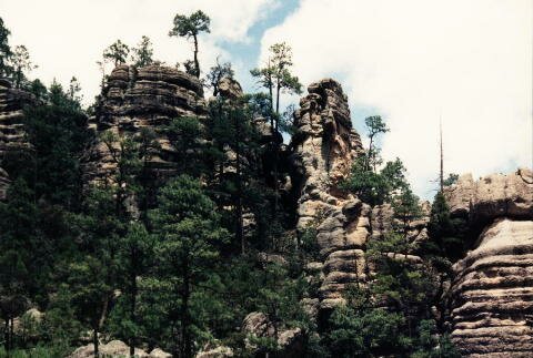
Geography The southern range of the U.S. Rocky Mountains after it exits the U.S. and enters Mexico is called the Sierra Madre Occidental. The portion of the Sierras that passes through the Mexican state of Chihuahua is also known as the Sierra Tarahumara. The major community in the Copper Canyon is the town of Creel.
The area called the "Copper Canyon" is actually made up of four major gorges, each over 5,500 feet in depth. These four gorges are known as Barranca del Cobre, Barranca del Urique, Barranca del Sinforosa and Barranca del Batopilas. Barranca is Spanish for "canyon".
In addition, there are more than 20 canyons in this mountainous region. The canyons cover over 20,000 square miles. The term "copper canyon" refers to the copper/green colored lichen that cling to the canyon walls. Copper was never actually mined in large quantities here.
Some of the many rivers that have created the canyons in this region are the Rio Verde, Rio Batopilas, Rio Urique, Rio Fuerte, Rio Conchos, Rio Balleza, Rio Mayo, Rio Tutuaca, Rio Aros and Rio Papigochi. Rio is Spanish for "river".
This region also holds Mexico’s two highest waterfalls, both in Candameña Canyon: Piedra Volada with a fall of 453 meters (1,494 feet) and Basaseachic with a fall of 246 meters (812 feet).
There are two distinct climatic zones in the region: alpine in the highlands and subtropical in the canyon bottoms. In the mountains October to early November and March to April have the most moderate temperatures--but even in these months, temperatures in the bottom of the canyon will be warm. July, August, or September is the rainy season, during this time there are afternoon thundershowers called monsoons for their intensity. In the canyon the temperature is warm and humid except in the winter when temperatures will be the least tropical. April through June are the hottest months. This is also the driest part of the year, with chronic water shortages.
What is the weather like in the Copper Canyon today? Follow this link to The Weather Underground for the forecast for the state capital of Chihuahua. Or check out this satellite map from Weather.com.
Try converting the temperature in your town from Fahrenheit to Celsius. Follow the directions in the box below, or manually calculate the temperature as follow:
convert C to F:
[(C x 9) / 5 ] + 32convert F to C:
(F-32) x 5 / 9What time is it in the Copper Canyon as compared to the time in your home town? Check out the World Clock at Time and Date.com (www.timeanddate.com/worldclock/city.html?n=65)
To learn more about the this region of the Sierra Madre Occidental, visit the web sites below.
Color Map of Copper Canyon & the Sierra Tarahumara
Sierra Tarahumara - Background information on the Sierras and several canyons by Adventures Great and Small.
Cusarare Canyon - Description of the canyon and the river falls.
Batopilas Canyon - Description of the canyon and town of Batopilas.
Tarahumara Indians - Background information on the people on places in the Copper Canyon by Balerrama Tours.
Copper Canyon - an overview - Canyon background from the Surf-Mexico travel page
Chihuahua Geography Mexico for Kids Site by the Presidency of the Republic of Mexico.
