April 14, 2010
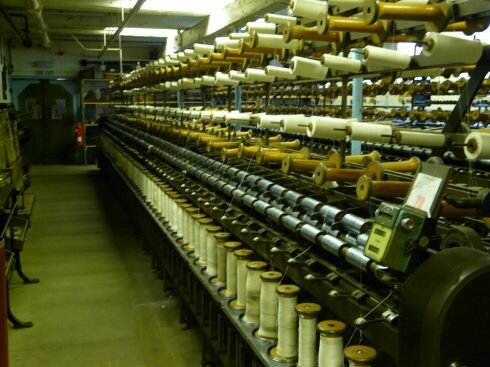
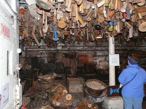
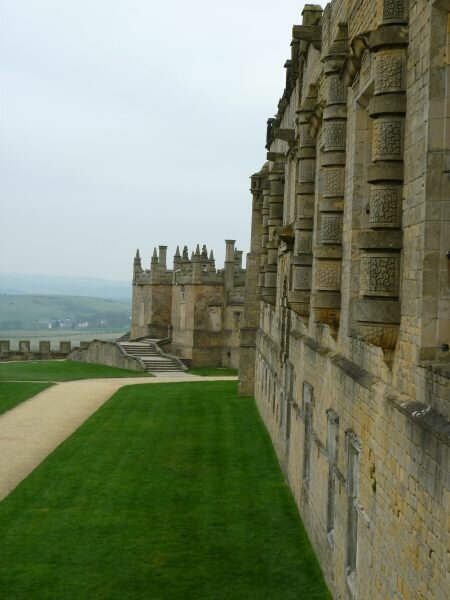
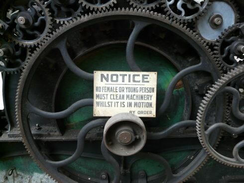
In the morning, we packed up and moved about 2 miles down the road to the parking lot of the Masson Mills. This old textile mill is a World Heritage Site due to its establishment as a water-powered mill using new technology for its time – 1783. What is even more amazing is that the mill wasn’t hooked up to the power grid until the 1950’s, and that it ran as a commercial operation until the 1970’s. It still operates, but only as a museum, but the equipment that has been updated is still in place, including the world’s largest collection of bobbins. The water wheels were replaced by steam generators and it still produces electricity that it sells back into the national electrical grid.
|
|
|
We spent a while wandering through the various rooms, examining equipment that did everything from processing the raw wool to spinning the thread and making the cloth. The people who designed these machines were building a new technology that had never been used before.
|
|
|
|
|
|
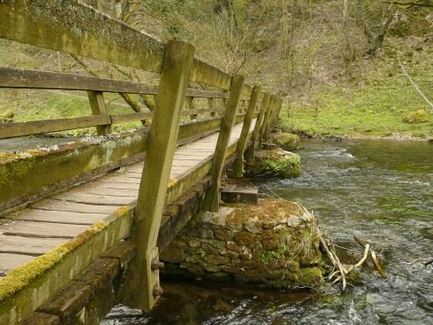
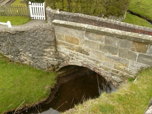
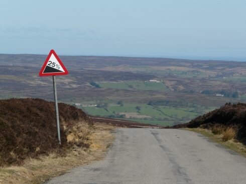
Later we drove through the dales of the Peak District National Park, driving down roads that were probably too narrow for us to be on, but challenging and beautiful. It feels like every little town should be included in the travel guides because they are so darn cute and there is always something interesting to see. At lunch time, we pulled off the roadway to find an old mill site bordering a stream that provided us with a nice quiet walk after we ate.
|
|
|
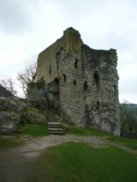
We climbed a hill to a twelfth century castle at Castleton and enjoyed the views up and down the valley. We did finally reach a road that was just too narrow for us to feel comfortable driving. In fact as we watched other vehicles on it, we realized that it was barely wide enough for two compact vehicles to pass each other on! Discretion – we turned around and found a different area to camp in.
|
|
|
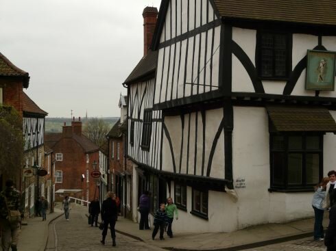
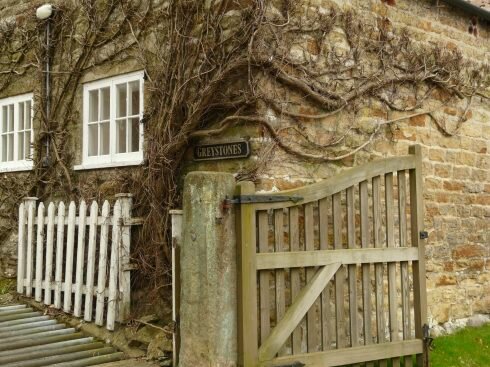
We stopped for the night in Eyam, just one more of the fabulous small country villages that have existed for nearly 1,000 years. We could just about throw away our guide books and wander the back roads between villages and never be disappointed. Every village is beautiful and full of interesting buildings.
Eyam’s claim to fame, if you want to call it such, is that in 1665, the village inhabitants contracted the plague. But rather selflessly, they chose to quarantine themselves in their village to stop the spread of the disease rather than infect their neighbors. By the time the disease passed, about a year later, half of the villagers had died.
We are driving a rather zig-zag route through England as we head north. The weather, although for the most part dry, has been cold for spring with day-time temperatures in the 50’s and nights below 40. This past winter was the coldest for some 30 years. We are on our way to Scotland, but we are driving slow for two reasons – 1) to see as much of England as we can, and 2) to delay in the hope that the weather will actually get a bit warmer.
| We have become members of English Heritage, similar in a sense to the Golden Eagle pass to the US National Parks. The difference is that English Heritage doesn’t manage parks, they manage historical locations. Now we can stop and explore any number of ruins, castles, churches and more, without having to pay an additional entrance fee. So we are taking full advantage and stopping at nearly every place that accepts our membership. |
|
|
|
We also happened across Sherwood Forest – we had lunch there – and yes it really is in Nottingham. |
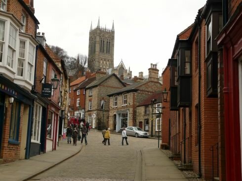
We headed east to Lincoln to explore its old town and wander its alleys up to its castle and cathedral. We are sure to get "castled out" as just about every city has a castle if not a cathedral, abbey or ruin of one of these.
As we wandered the streets, we were impressed with all of the walk-only streets. It makes exploring so much more fun when we don’t have to share an alley with exhaust fumes and loud vehicles. We also like the British sense of naming streets, they are very practical. How so? How about Steep Street, or maybe Church Lane or even Castle Way. And when we’re driving between towns, the roads are easy to find since the roads are named for the next village down the road. So when we’re leaving town A, we just look for the road named Town B, really!
|
|
|
If you’re wondering about where we spend the night, let me explain. We rarely stay in private campgrounds as not only are they expensive, but they are generally located miles away from the center of the town that we want to visit. So we usually stay overnight in public parking lots. This may sound strange, but it makes perfect sense. First off, we are within walking distance of everything we want to visit in a town. Next, the lots are usually inexpensive and are used by buses and trucks to overnight as well.
Most of the towns and cities in the United Kingdom are not very motorhome friendly, not withstanding the fact that a large percentage of the population own either a motorhome or a travel trailer. Finding parking is very difficult. About the only vehicle that doesn’t have an issue is something along the size of a VW campervan.
We try to follow the signs to lots that are used by buses, but signage isn’t always that great. Oh yes, and then there is the little problem of barriers. Many towns allege that they have problems with "gypsy" travelers who supposedly take up residence in their car parks, so their solution is to put up height barriers restricting entrance to vehicles taller than about 6 feet. Nobody really understands this gypsy problem, after all, the local police can just move undesirables along. What these barriers do is prevent vacationers or travelers from stopping and visiting their towns. So effectively they are preventing us from supporting their merchants and spending our money in town. Strange and terribly short-sighted.
|
|
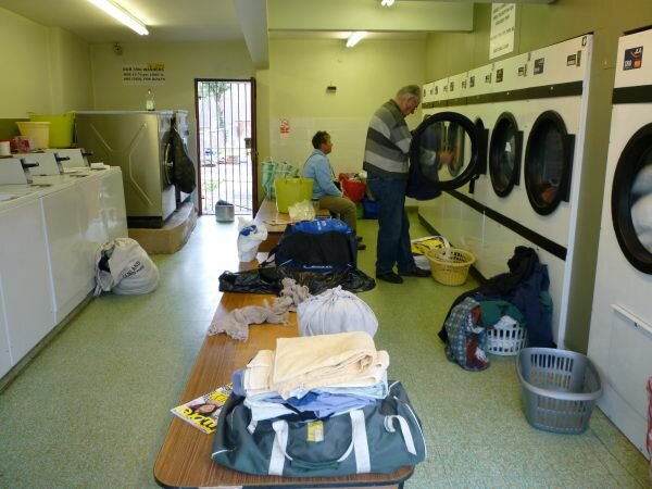
In the morning we tracked down a Laundromat. While we were waiting for our clothes we walked up the street to a little coffee shop. While we enjoyed our coffee and scone we found out about the volcanic eruption in Iceland. All flights in the UK and across northern Europe have been cancelled due to the amount of ash in the air. Wow, and we thought we had problems when our flight was cancelled due to the British Airways strike. |
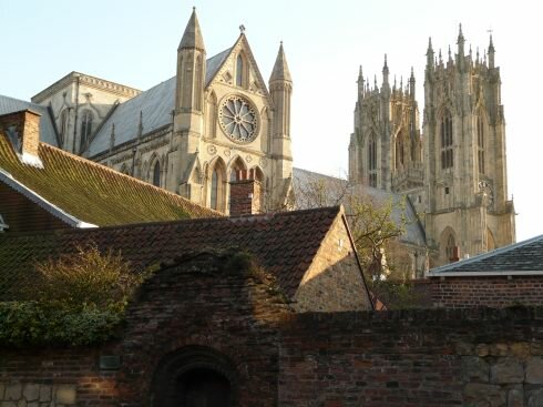
| Moving on, we found a nice quiet car park in the town of Beverley, a town known for its large and very ornate church. I make it sound like finding the car park was easy, but we only found it after circling through the city about three times. Now the church, although it is very large, it is not a cathedral. We’re still coming to terms on how to distinguish one from the other. The town also has great walk streets and a Saturday market, so we wanted to visit their market. |
|
|
|
|
That night we treated ourselves to drinks at our first pub, and enjoyed a dinner at a restaurant. Friday night, the walk streets were nearly deserted, but on market day, boy, it seemed that everyone in town was out and about. Well, we’re sure that the weather didn’t hurt, it was a sunny day – maybe the warmest day of this expedition.
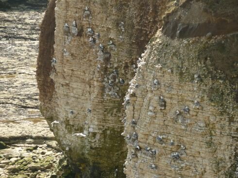
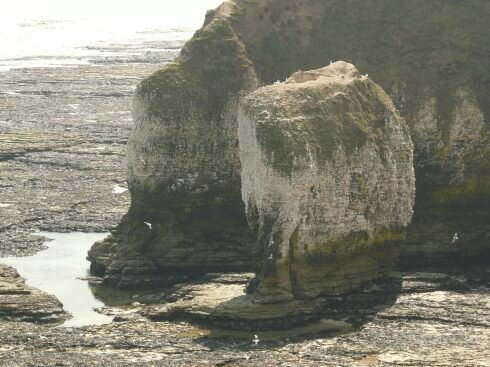
After sleeping in and getting a late start on Sunday, we continued northward and reached the eastern coastline. We enjoyed a hike along the cliffs at Flamborough Head and its lighthouse. We saw tons of nesting waterbirds, but for some reason we had left our binoculars in the truck. Well all things happen for a reason, this time it turned out that one gentleman who was standing near us offered us his binoculars, then told us about a nature reserve just up the road that was THE place to go. So we said thanks, and headed up the road.
|
|
|
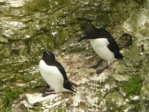
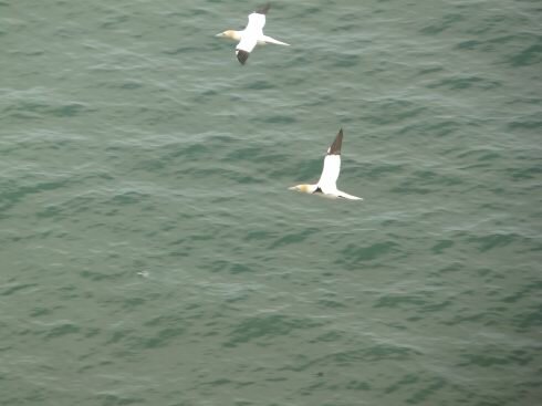
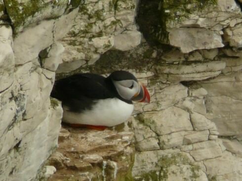
It turned out that Bempton Cliffs, RSPB (Royal Society for the Protection of Birds) operates this reserve that encompassed 3.5 miles of cliff-top viewing of what is England’s largest seabird colony with 200,000 nesting birds! And they allow overnight parking in the reserve, what could be better? (It also turned out that our friend Les had recommended this spot.)
And the birding couldn’t have been better. We saw many of the same birds that we saw in Norway, but here they were building nests on tiny little ledges on the cliffs above the crashing surf. There were seven main birds, Herring gulls, fulmars, kittiwakes, and our favorites – Gannets, guillemots, razorbills and the incredibly colorful puffin. Despite the wind and the cold, we had a great time watching the birds, before returning to our great quiet cliff top camping spot.
|
|
|
|
|
|
In the morning we continued northward. We drove through the very touristy city of Scarborough to check out its waterfront and castle. Parking was again difficult so we decided to continue on into the North Yorkshire Moors National Park.
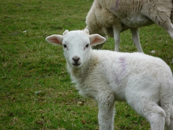
Three-quarters of the world’s heather moorland is found in Britain and this park protects the largest expanse in England. The heather blooms in summer, but the bleak, open fields were an impressive sight. The villages are all filled with gorgeous stone cottages, grassy knolls and free range sheep everywhere.
Again we drove on narrow roads, but we’re getting good at this although at times it is still uncomfortable. Like the time we drove through a town and had to drive up on the sidewalk in order to get around vehicles; or the times we have to stop, as close to the hedges as possible, to let an oncoming vehicle pass by. Again, there were all of these picture perfect villages that we had our choice of to explore.
|
|
|
|
|
|
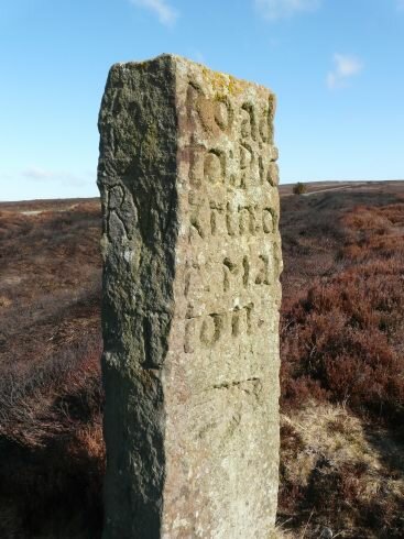
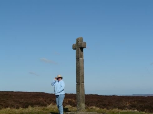
We picked a great little spot off the road at the top of the moors to camp. We watched red grouse and pheasants in the heather. We hiked to several weather-beaten stones set in the moors to mark the lines of ancient roads that were followed by shepherds and their sheep.
|
|
|
|
|
|
The park covers a huge area. In the UK parks may be managed by the parks authority, but most of the land is privately held. It seemed strange to see so many sheep wandering the moors, but this supposedly keeps the weeds in check and helps the moors to survive.
|
|
|
|
|
|
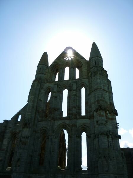
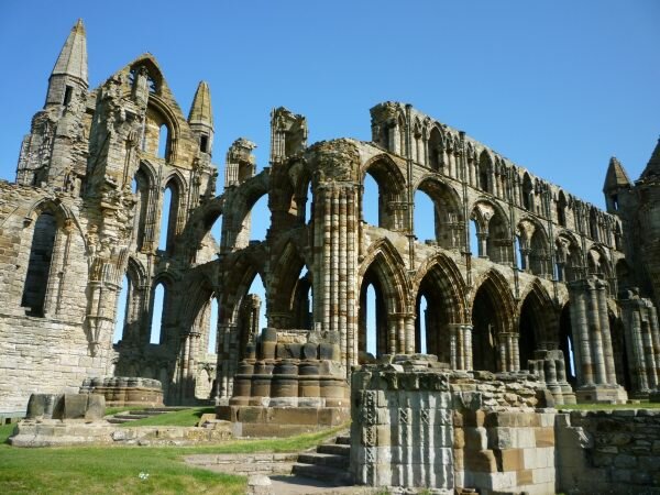
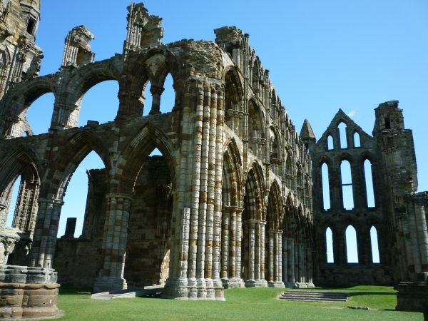
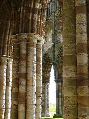
From the highlands of the moors, we drove to the coast to Whitby (still in the park) to view the impressive ruins of the Whitby Abbey. The abbey was founded in the 12th century and grew and grew until Henry VIII (the 8th) in the early 1500’s split with the Roman Catholic Church marking the English Reformation. At that time the Abbeys were so wealthy and powerful, they owned nearly 1/7th of all lands in England. Then Henry dissolved the abbeys and monasteries and took over their wealth and lands. The abbeys and monasteries were pretty much destroyed and the cathedrals were converted to the Protestant Church and nearly all the statues were destroyed or defaced.
This was the fate of the Whitby Abbey which now looks over town with its ruined outline dominating the sky. These ruins, plus the narrow streets of town were the inspiration for Bram Stokers’ Dracula – not Transylvania!
|
|
|
|
|
|
Another short historical note is that Whitby was the home port for Captain James Cook. This was interesting for us since we have visited statues and commemorations to Capt Cook in New Zealand and Australia. Oh yes, we did again stay overnight in a quiet car park on the cliffs overlooking the ocean.
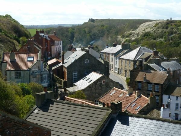
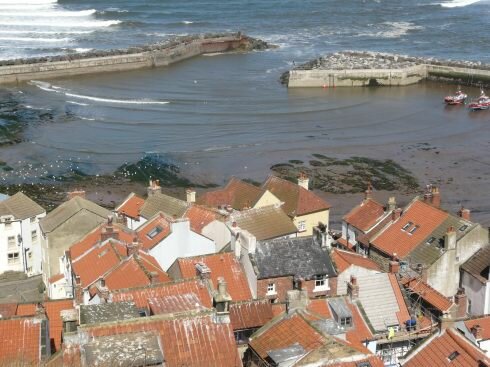
For a change, for us, we decided to "put on the miles" and drive a longer distance than our usual 50 miles or so a day. We did stop at a small fishing village that we had heard about called, Staithes, that is literally cramped into a tiny space between the base of cliffs and the mouth of a small river. It is really picturesque and we saw photos in a restaurant, of the town being battered by a big storm.
|
|
|
We passed through several industrial cities and ports and made for what we hoped was an empty coastline for a walk along the beach and a quiet, wild camp. What a surprise, our very first stop and we found a great cliff top free-camp that bordered a local nature reserve just north of Hartlepool.
|
Home UK Journal |