Posted May 6th
We've played cat and mouse with a late spring storm ever since we left our base in Prescott, Arizona. We have driven through either snow flurries or rain all the way to Canada. Finally, the snow caught us in British Columbia.
Yet along the way we found so many interesting things that we'll have to plan an expedition just to explore the western United States. We saw the glitter of Las Vegas, the stark beauty of the White River Narrows and the ancient petroglyphs found there. We crossed the Pony Express Trail, drove along the Oregon Trail and along the Snake River in Idaho. There was the 45th Parallel which marks the half way point between the Equator and the North Pole.
Our journey just to arrive at the expedition starting point at Stewart, BC/Hyder, AK has been a series of long driving days. One interesting fact, the further north we go, the longer it stays light. So when we do arrive at our daily destination we still have enough light to take a hike and stretch our legs a little bit.
The first night out we made camp in the canyons of the White River Narrows Archeological Area in central Nevada. This is a beautiful old river canyon strewn with pictograph and petroglyph covered boulders and rock faces. We took a great hike exploring the canyons and searching out the art work.
The second night found us along the bank of the Snake River in southern Idaho. Here we enjoyed the peacefulness of the river and used our bird books to identify as many of the birds as possible. The next morning we visited the Hagerman Fossil Beds National Monument and discovered that the area directly across from our camp is a world renowned paleontological site where the fossils of over 150 species of animals have been found, including the Hagerman Horse, an extinct horse found nowhere else in the world.
The third night found us seeking refuge in an RV park just south of the Columbia River in Oregon. The afternoon had us battling winds so fierce that the dust it kicked up reduced the visibility on the roads. Rather than trying to find a spot along the river as planned, we chose to seek shelter in a park. It was a wise choice as the winds did not let up until morning. As a benefit, we were able to find a spot out of the wind and still use our BBQ to cook dinner.
Our fourth night was spent at the Larrabee State Park just south of the Canadian Border, near Bellingham, Washington. This park is set right on the shore of Puget Sound. The longer day gave us time to hike and explore the trails and the beach.
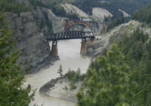
Driving towards Alaska we drove alongside the Fraser River through British Columbia. If we were exploring BC, we'd tell you how this river was charted by Simon Fraser and how many features such as lakes, rivers and towns were named after him.
| But we're not, so... But here's a great photo of the twin train bridges as they cross the Fraser River. |
|
|
|
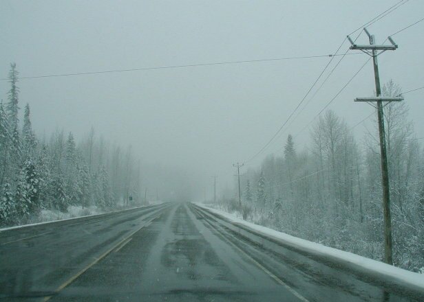
The last two nights were spent hiding in the expedition camper during frequent snow storms, even though our camps were more than 300 miles apart. |
|
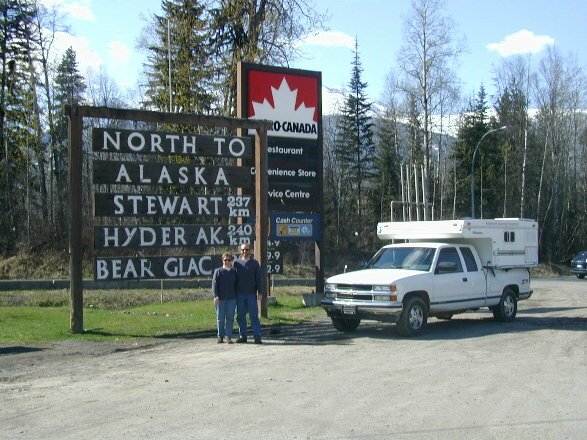
Today we will arrive at our Expedition starting point at Stewart/Hyder.
|
|